Alpine expedition Monte Rosa 2017: Punta Gnifetti (Signalkuppe) 4554m, Parrotspitze 4432m, Ludwigshöhe 4341m, Balmenhorn 4167m
Day 1. Krakow - Prague - Milan - Pont-Saint-Martin - Staffal
In twenty years more you will regret what you did not do than what you did.
So unlatch the ropes, leave the safe harbor.
Catch the successful winds.Travel. Dream. Discover.
Mark Twain
The Alps are mountains that infect with their beauty. If at least once you go on alpine hiking on the summits and feel boundlessness and freedom, you will always want to go back there.
Our goal: Monte Rosa


It consists of over ten four-thousanders, of which the highest Dufourspitze, 4,634 meters above sea level, gives way to only the highest alpine mountain - Mont Blanc 4810m above sea level
Beginning of the trip:
The beginning of our road took place in Krakow, from where buses depart in all directions of the world.
Currently, a large number of international connections made traveling around Europe really easy. Getting to the main European cities is no longer a problem. It is also often the case that a city chosen by us can have up to several calls a day and the price of a ticket booked early is similar to the price of a cinema ticket. Thanks to this, we save money that we can spend on the spot on the spot :)
The purpose of our trip was the Italian alpine town of Staffal, where the routes leading up the Monte Rosa massif begin. We estimated that it would be the best to get there from Milan. A 24-hour bus journey from Flixbus awaited us from Poland to Milan. Fortunately, a nice diversion of the road turned out to be a more than four-hour stopover in Prague at that time, thanks to which we could enjoy the Old Town of the Czech capital.


From Prague on a further 14-hour journey, another Flixbus we went to Milan itself, and more precisely to the Lampugnano bus station. He did not look too inviting, so as soon as possible we wanted to escape from there and continue the journey.
Short description Lampugnano: beard, stench and traders who try to push everything from mineral water to a Gucci or other Armani leather bag.
Milan is about 140 km away from the next, mountainous Pont Saint Martin. Finding a connection is not a problem at all. Both buses and trains arrive there. The cost is about 10 €.


Pont Saint Martin turned out to be a small, atmospheric town. From the central square, every now and then, the buses to the last point of our tour - Staffal. The cost is about 3 €.


Staffal is a small town, located at an altitude of 1800m above sea level. This is where the routes leading to the Monte Rosa massif begin. From it there is a beautiful view of the glacier reigning above. It is filled with stone and wooden houses and guesthouses. You can eat a good Italian paste in the inconspicuous Klein Finnland bar.
This time we also found out about the hospitality of the Italians who allowed us to pitch our tent for free in our yard.
It is also worth noting that there is a camper parking in Staffal, which you can use for a small fee from toilets and showers.
After seeing the town, it's time to relax. The next day we were about to overcome almost 1700m altitude. We had a plan to get to the Italian Rifugio Mantova.

This day began very early because around 5 o'clock in a tent crashed in the garden of very nice and helpful Italians, who let us spread it in front of their home.
We had an ambitious goal because we wanted to reach the Italian hostel Mantova located at an altitude of 3498m above sea level
We had to overcome almost 1700 m altitude.
Ultimately, we did not get back to the road until about 7 o'clock.
There are many ways to get from Staffal to Mantova. Depending on the time and condition, it is possible to choose from several hiking trails.
Below is a map on which all the routes are clearly visible, along with a description of their difficulties.
This time we also found out about the hospitality of the Italians who allowed us to pitch our tent for free in our yard.
It is also worth noting that there is a camper parking in Staffal, which you can use for a small fee from toilets and showers.
After seeing the town, it's time to relax. The next day we were about to overcome almost 1700m altitude. We had a plan to get to the Italian Rifugio Mantova.
Day 2. Staffal - Rifugio Città di Mantova
"Life is not about waiting until the storm passes ...
It's about learning to dance in the rain "
Vivian Green

We had an ambitious goal because we wanted to reach the Italian hostel Mantova located at an altitude of 3498m above sea level
We had to overcome almost 1700 m altitude.
Ultimately, we did not get back to the road until about 7 o'clock.
There are many ways to get from Staffal to Mantova. Depending on the time and condition, it is possible to choose from several hiking trails.
Below is a map on which all the routes are clearly visible, along with a description of their difficulties.

There is also the possibility of a significant shortening and speeding up the path by choosing one of several queues running in this place.
Below there is a peg of queues along with travel prices.
Below there is a peg of queues along with travel prices.

By train you can get to the lake and the Gabiet shelter, to the altitude of 2318m above sea level and even to the altitude of 2,971 m, to the Passo dei Salati, from where you can reach the Mantova shelter only about 2 - 2.5 hours.
We chose the option of walking route 7A and 6A and we have not regretted this decision for a moment. Route 7A in accordance with the signs in 1.45h we had to get to Rifuggio Gabiet, from where it was necessary to follow the road 6A, which led directly to Mantova.

Initially, with some uncertainty, we moved up. Uncertainty was caused by unfavorable weather forecasts for the coming days. We learned from the locals that it should be stormy and rainy, and in the higher parts of the mountains snow would fall, which may cover the cracks in the glacier, reducing the safety of movement.
Unfortunately, the forecasts were confirmed very quickly because after a few minutes after the start of the trip, he began sprinkling rain. Fortunately, it did not last long and was not strong enough to stop us .
Unfortunately, the forecasts were confirmed very quickly because after a few minutes after the start of the trip, he began sprinkling rain. Fortunately, it did not last long and was not strong enough to stop us .


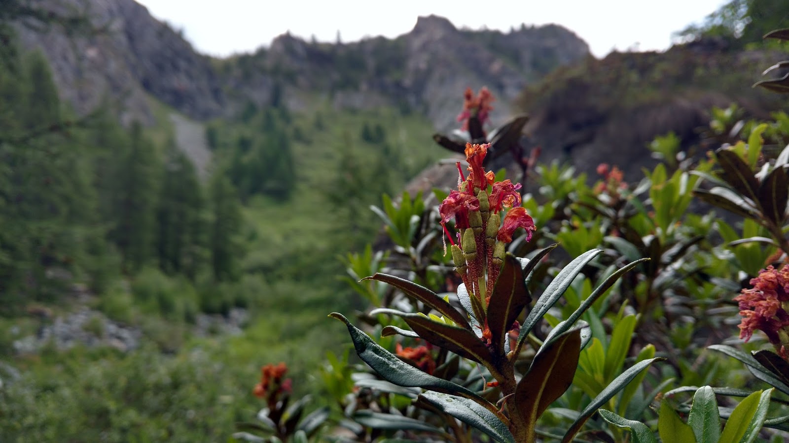


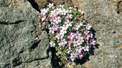
A walk through the beautiful, green valley of Aosta, even with a heavy load, and despite not very favorable weather conditions, was an amazing adventure. The trail was pleasant and scenic and the valley was constantly surprising with interesting alpine vegetation with the predominance of many-colored alpine flowers.

From time to time it was also possible to meet funny wooden figurines, which in an interesting way blended with the landscape.


In our opinion using the queue in such an amazing place is a waste and resignation at your own request from a large part of the trip and surprises that await you in the mountains.


At the Rifuggio Gabiet shelter, the rain intensified and forced us to take an hour's break, which turned out to be a very nice diversion of the route.


In the middle it was very atmospheric and despite the early hour, we had the opportunity to eat delicious Italian paste and crespella.
Using the weather window, we set off from the hostel on our way. From that moment, we followed the route 6A. According to the signs from Rifuggio Gabiet to Mantova it was 3.5 hours.


The landscape began to slowly change from green, calm, valley to more harsh and rocky.


From time to time, the view of the majestic glacier and the Vincent's Pyramid towering above it pierced through the mist. This image on the one hand was delightful, but on the other hand, it aroused respect.


More or less halfway from Rifuggio Gabiet to Mantova, there is a chance to stay in one hostel, Orestes Hutte.

It looked very inviting from afar. An interesting fact is that it is a vegetarian-friendly place because it offers only vegetarian dishes.
In order to get to it, it was necessary to go a bit off the trail, so that after a dozen or so minutes to be at the shelter.


We, however, decided to go further, hoping that we will be at the beginning of Mantova before the rain or worse.
Unfortunately, the clouds had completely different plans and surprised us an hour before the shelter. Literally, in one moment a storm broke out, on one side it was terrifying, but on the other it was also amazing. Thanks to it, we literally felt the power of nature.


Fortunately, the convenient stone pit that served as a shelter helped to wait out the raging storm.

After less than 40 minutes of real, sky-high cinema, using the momentary weather window, we went up. The terrain turned into a rocky-snowy road.


The weather window did not last long, however, and before we looked again, we were in a storm cloud. The only thing that could be done in this situation was to drive towards the shelter as much as possible in the legs and lungs.
Time lengthened mercilessly, so that the last hour of the approach seemed to last for all eternity and the cloud-scattering contour of Rifugio Città di Mantova approached very slowly. The whole thing was complemented by fatigue that was noticeable.
It's hard to describe how big was our joy when we finally reached the last stone steps that ended on the terrace of the hostel.

Rifugio Città di Mantova turned out to be a very large and modern hostel, built on a rock, with a huge mountain dining room. In its offer has delicious food and accommodation. The only drawback was the lack of showers. Below is a link to the hostel's website:
http://www.rifugiomantova.it/

We did not have to hurry so much that day. We had one goal - acclimatization. Originally, we planned to reach the Gnifetti hut, which we chose as the main base, from where after lodging and leaving things we wanted to set off a little above the shelter, to the glacier, to get to know the terrain and get the organisms to the heights. Unfortunately, due to unfavorable weather, the whole plan could not be implemented.

Initially, starting the day with breakfast in Mantova, we collected the items and about 9 o'clock we set off up to Rifuggio Gnifetti.
The route from Rifuggio Mantova to Gnifetti is very simple. The hostels are very close to each other. They are separated by about 40 minutes mainly of the snowy passage being the remnant of the Garstelet glacier.
In addition, the second shelter is clearly visible from one.

Before we looked back, after defeating the snowy bend, we got to the short ferrata that led to the hostel terrace.

Rifugio Gnifetti looked amazing from the bottom up, but at the same time it filled with even greater admiration. We decided unanimously that it is the best shelter we have ever visited.


It was built on a rock at an altitude of 3647 m above sea level. It is unique due to the fact that it is a direct neighbor of the huge Lys glacier, as well as four-thousanders lying on it.


From the terraces and windows there is a marvelous view of the alpine peaks stretching all the way to the horizon, including the Gran Paradiso and Mont Blanc massifs, as well as the view of the downhill slope of the Lys glacier with its huge crevasses.
All this together impressed the eyes.


The hostel thanks to its location is a very good base for nearby four-thousanders.

We were pleasantly surprised by the conditions that prevailed inside. Positive staff, who despite the "crowds" very well took over the situation, delicious food, which nobody expected at this altitude, a large selection of local beer, access to showers, bathroom with a view of the glacier, comfortable, 3-story beds, warm rooms .. you could exchange and exchange like that.


After settling in and repacking heavy backpacks, the weather effectively thwarted our plans for going somewhere higher, to the glacier area, for acclimatization purposes.Rifuggio Gnifetti suddenly became a place like a dream. We were literally in the cloud.Such a state, unfortunately, lasted for most of the day, alternating with snow, storm and temporary sunshine.


Nothing, however, lost because during waiting, to our surprise, we were lucky to meet two great Polish teams :)


Today we woke up a few minutes after 4 o'clock. Despite such an early season and the fact that even the sun still sleeps well, the whole hostel has been full of life.
But we were completely lifeless this morning ... Altitude sickness in a remarkable way let us know.
We did not expect it to be so badly the more so that the previous night we spent just 200 meters below without any symptoms.
It was hard for us to get out of bed, not to mention moving or eating anything.
She manifested herself mainly with headache, dementia and lack of appetite ... And you had to eat, after all the glacier waited.
...
In the end, we managed to collect somehow, prepare the equipment, tie the rope so that we were ready to wander.
After leaving the hostel fresh and cold air and great views definitely improved our condition.
The weather was fantastic and the transparency of the air was so amazing that we could easily see the Mont Blanc and Gran Paradiso massifs on the horizon.


On that day, we were planning to identify the situation on the glacier regarding the number of gaps and possible threats. We also wanted to see how the road to peaks really looks like, which we planned to get in Poland and which we knew only from maps, photos and guides.
To get even better acclimatization, we also planned to go to one of the four-thousanders closer to the hostel.


To get to the glacier, you had to leave the safe rock cape on which stood Rifugio Gnifetti and descend using a short ferrata located at the end of the stone path at the back of the hostel.
After getting to the area, the path clearly visible, trampled by the earlier teams determined the further part of our journey.


Taking the heights, we were heading up the glacier.
The initial sections of the road were quite crevice and demanding.


We were walking among the powerful peaks.


On the right, the Vincent Pyramid towered above us with its stunning rock wall, decorated at the foot of giant ice seraks.


As we moved up, on the left side two Lyskam tops showed up.
On the first of them, Lyskamm Orientale (Lyskamm East) ran an amazing snow, steep ridge.


After defeating the first elevation, we reached the plateau of the Lys glacier.


From this perspective, the Vincent's Pyramid no longer made the impression of such a difficult and inaccessible mountain. The path that led her ran calm, snowy turns.

The rocky peaks of Corno Nero (Schwarzhorn) 4 322 m above sea level and Balmenhorn 4167 m above sea level appeared in front of us with a huge statue of Christ (Cristo delle Vette) visible on its top and Bivacco Felice Giordano shelter.

As the height of the Corno Nero grew, it appeared to be an increasingly interesting mountain with a very steep slope separated by a fissure.


We wanted to go as far as possible and as far as possible to see the path leading to the peaks of Punta Gnifetti (Signalkuppe) and Punta Parrot (Parrotspitze), which we planned to get the next day.
For this purpose, a narrow snowy ridge of the Ludwigshöhe summit was the best, from which the next part of the glacier was well visible.

As we approached, the sun rose higher and higher, pleasantly elevating the temperature of the surroundings, and strong gusts of wind soaked up the clouds of snow, creating spectacular performances.


The Ludwigshöhe summit, 4341 m above sea level, actually turned out to be very narrow.


When we passed it, the wind effectively took care that we would not be bored. A fairly strong breeze meant that the passage was exciting and the view of the other side of the glacier intensified these emotions :)

After descending from Ludwigshöhe, due to the early hour, we decided to enter the Balmenhorn. The road did not cause any difficulties. At the rock itself there was a short ferrata that led to the top.

On it stood a huge figure Cristo delle Vette with a height of 3.6 m and a weight of 980 kg.It was built in honor of the memory of the fallen of all wars.


We were very surprised by the conditions that prevailed in the local shelter. It was equipped with solar screens which ensured access to electricity.
In the middle there was a place to prepare a meal, a gas stove, a wooden table and benches, and a place to sleep. The surprise was also the fact that the range contained mattresses and blankets.

From the balcony there was a view of the steep, rocky slope of Corno Nero and the road leading to the top of the Vincent's Pyramid.


After leaving Balmenhorn we headed back towards Rifugio Gnifetti. The road took us about an hour and was filled with beautiful views.


The day ended with a beautiful sunset that we could see from the Gnigfetti hostel :)


 "When at the beginning of climbing a man stands before the summit and looks at the mighty mountain, he feels overwhelmed." When he looks at the same mountain after descending, he is proud and has the impression that he can achieve anything. "
Martyna Wojciechowska
It was still dark outside ... and although it was not easy, we woke up at the alarm clock at 4:30.
As every day, the hostel was vibrant with life at this time.

That morning the morning looked completely different. Fortunately, altitude sickness has gone forever. There was no headache, no dementia, no lack of appetite. We felt great, motivated and ready to act.
A new unexplored part of the glacier and above all two amazing peaks awaited us:
- Punta Gnifetti, from the German Signalkuppe, at its peak, at 4554 m above sea level, stands the highest located tourist hostel in Europe.
- Punta Parrot or Parrotspitze 4432m above sea level, a great, long snow ridge high in the clouds.
Even breakfast this time tasted exceptionally good. The charms surrounding the mountains emerging from the darkness added to his charm.

This time, we did not have to prepare too long to leave.
We packed our backpacks and equipment the day before, so that they waited in readiness.
All you had to do was dress up the crampons, tie up the rope and check the belaying.


The weather of that day seemed to be even better than yesterday, and the air was so clear that we could admire the amazing beauty and power of the mountains to the horizon.

We defeated the first fragments of the glacier in the light of the rising sun.
Just like yesterday on the right we passed the Vincent's Pyramid, on the left an amazing Lyskamm ridge, and finally after reaching the first elevation we reached the Glacier Plateau.


This time we left Balmenhorn, Corno Nero and Ludwigshöhe behind us and after crossing the Lys Pass, we reached the Grenz Glacier.


What we saw after exceeding a slight surpass exceeded our wildest expectations.


Three huge peaks appeared to our eyes, from the left: Dufourspitze, Zumsteinspitze and Punta Gnifetti.


To the east stretched a vast panorama, against which the characteristic Matterhorn peak was clearly visible.


Continuing our journey along the eastern slope of the Parrotspitze after about 30 minutes we found ourselves in a place where the road went steeper and led to the Gnifetti mountain pass (Colle Gnifetti) separating the peaks of Punta Gnifetti and Zumsteinspitze.


The entrance to the pass was relatively easy. It did not cause any orientation problems, especially since everyone moved the same, well visible, well-trodden path. Rather, it was associated with a painstaking journey along a strongly sloping snowy slope. The only drawback was the altitude, which most gave itself to know on the steep sections of the road and enforced the slower pace of the march.


Only the last but the most difficult 102m approach was left from the pass.
Time was very long and our goal was not approaching at all.
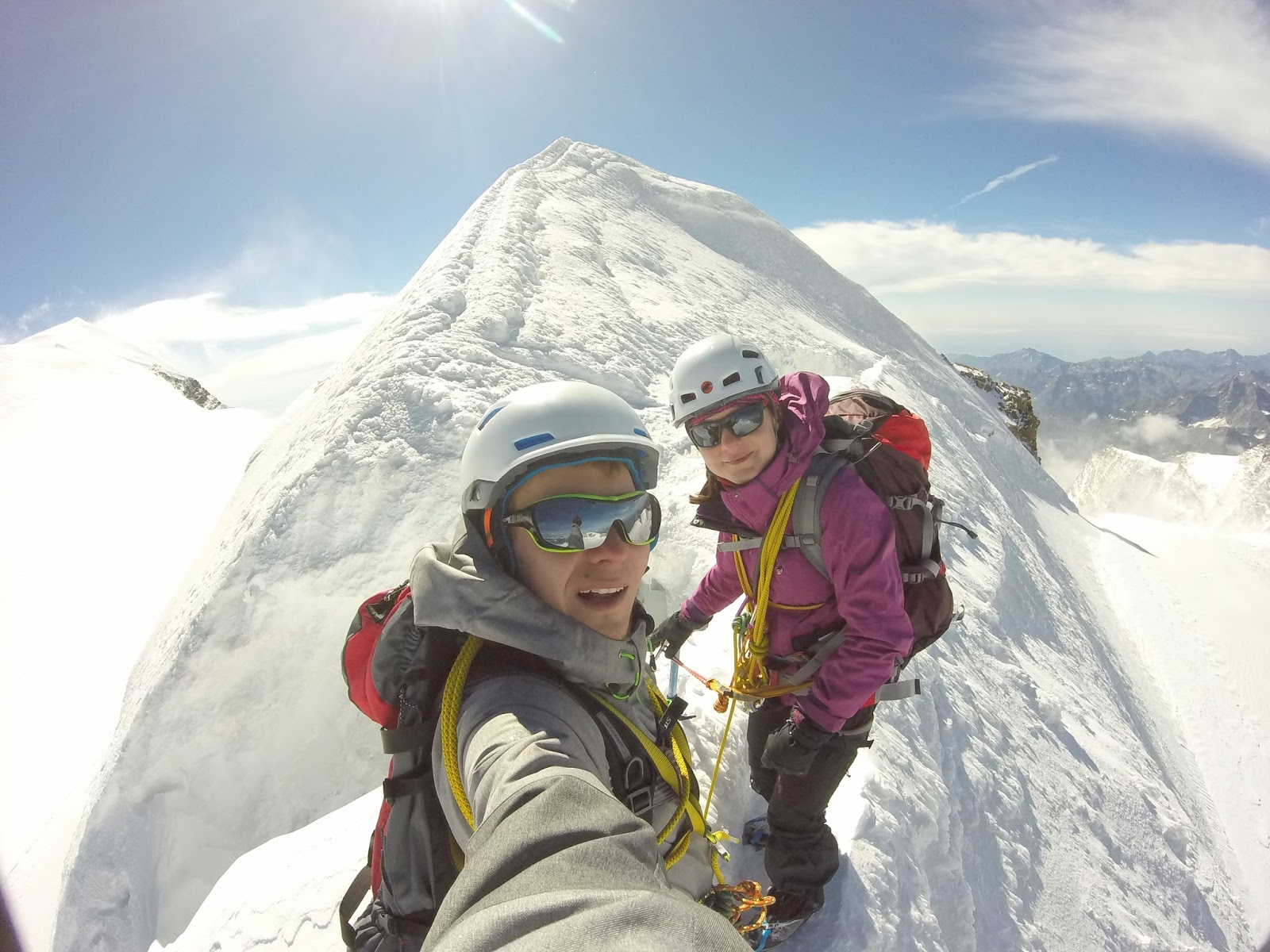
Finally, after defeating a long hump, we were able to enjoy the summit! :)


In the mountains you can see many beautiful landscapes, but the view from Punta Gnifetti was something special. We were literally above the clouds.


Looking in the direction from which we came, you could admire the amazing panorama of most of the peaks of the Monte Rosa massif.
In the immediate surroundings from the left you could see: Parrotspitze, Roccia della Scoperta and Lyskamm, while on the right - Zumsteinspitze and partially covered by the highest peak of the Dufourspitze massif.
In the background there was a characteristic Matterhorn in the vicinity of other towering mountains, among others Dent Blanche and Weisshorn.

Looking the other way, we were enchanted by the sight of an amazing, several hundred meter chasm, below which the peaks of the lower mountains and the beautiful green valleys of Alta Valsesia and Alta Val Strona crossed the sea of clouds.


For over 100 years at the top of Punta Gnifetti stands a very modern hostel / observatory.It is worth emphasizing that it is the highest located tourist hostel in Europe.
He mainly conducts high-altitude scientific research and improves rescue operations.


It also has sleeping places (for 70 people), bathrooms, a bar and electricity.
While there, we had the opportunity to drink a delicious coffee by the window with a view of the Dufourspitze.


After an hour's break and recharging, we went on a further journey. Our next goal was to get the Parrotspitze summit and the passage of its incredible snow peak.
To do this, we had to go back exactly on our tracks: first to the Colle Gnifetti pass separating Punta Gnifetti from the nearest neighbor, Zumsteinspitze and then to the Seserjoch pass visible below, which separated the peaks of Punta Gnifetti and Parrotspitze.


The Seserjoch Pass is located at an altitude of 4296 m above sea level, so we were losing altitude by over 250m. The long snowfall that we have recently covered in the previous direction has passed very quickly.
After about 40 minutes after leaving the Punta Gnifetti summit, we started approaching the Parrotspitze.


The weather began to deteriorate significantly, the wind was getting stronger and the visibility weakened.
Being on the pass, we had a lot of doubts whether we should go on.
Now we do not regret this decision.


A few minutes after leaving the pass we entered the peak of the Parrotspitze.
A chasm covered by the clouds below fell to the west and a steep snowy eastern slope was separated by a narrow path leading once along the sharp edge of the ridge, and at other times in its immediate vicinity.


The Parrotspitze ridge is a great place to feel the real power of nature and to realize the majesty of the mountains.


After spending about 30 minutes high in the clouds, the road began to descend and point us back towards the glacier. The descent from the summit ended with a short rock climb in an easy terrain (you should still be vigilant there).

After descending from the rocks, we headed for the Vincent's Pyramid and returned to the well-known way to the shelter.

During the descent from one side we were accompanied by a feeling of great happiness due to a very successful mountain adventure, on the other hand, however, slowly came to us the thought that the Alpine journey is coming to an end.

The day started for us later than usual. Completely ignoring the morning hustle and bustle, we slept through sleep deprivation and gained strength for the return journey.
That day, we were no longer aiming to gain great peaks, we just wanted to go down to the Alpine village of Alagna at the foot of the Monte Rosa massif.


The mountains said goodbye to us with the beautiful sunny weather that accompanied us until the evening.
We did not rush, we started to descend only around 10 o'clock.


The first point, which we had to look at was located near the hostel Mantova.
A few days earlier, in order to get rid of the excessive weight, we left a tent there.
The road to Mantova did not cause us any difficulties. The lower located hostel is clearly visible from the terrace of Capanna Gnifetti.
To get there, we had to go down a well-insured ferrata and then go through a long snowbank through the small Garstelet glacier.


From the Rifugio Mantova hostel, we follow signs for the Passo Dei Salati pass.
An additional charm of our way of descent was added by the fact that we planned the return with a completely different route than at the entrance.


Initially, he led a scenic, stony path that connected with the Indren Glacier, located at the foot of the Vincent and Punta Giordani Pyramids. Then we were waiting for a short, undemanding passage through the glacier, to the downstream newly built cable car station located at the top of Punta Indren.


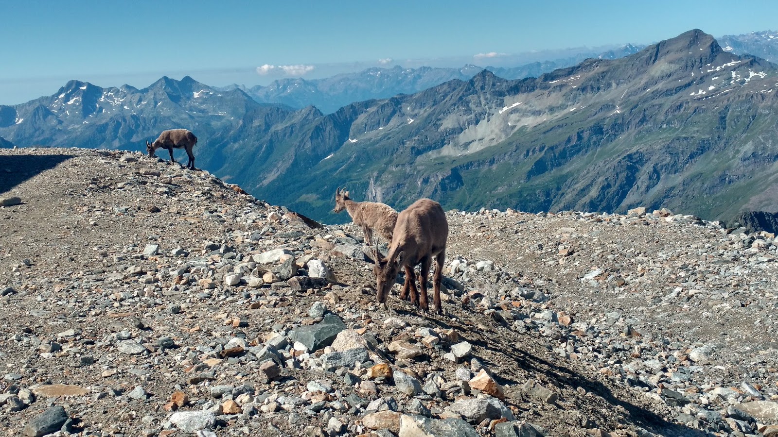
At the station of the queue we met a very nice surprise. A herd of tiny Alpine ibex grazed near the building, which was not disturbed by the presence of people.


The further course of the road turned out to be very uncertain.
At this point it was necessary to head east (to the left) to the visible, now closed station of the cable car on Punta Indren.
The road led through a rocky terrain alternately intertwined with large snow patches.


 After reaching the former railway station, the route markings returned. According to them, we headed down a cliff, from which stretched a beautiful view of the Aosta valley.


Then the road led towards Stolenberg, which is just in front of us - another surprise of the day.


The trail led a beautiful and delicately displayed road traverse the slope of the mountain rising up and approaching its peak but eventually not reaching it. We then made one attempt to get the mountain "on our own," however, the falling of small stones effectively changed our decision.


Being on the other side of Stolenberg, we found ourselves on the pass Passo dei Salati, where there was another, modern station of the ski lift. Below it, there was a hostel building.


 After descending from the pass, we entered the area the beautiful and green Italian Aosta Valley. However, the beauty of the valley was disturbed by the fact that the next road was already in the vicinity of ski slopes, ski lifts and mountain railways. From time to time we passed, among others, abandoned buildings of old shelters and ski infrastructure.


Going further, with the loss of altitude, our goal began to show up and the end point of the trip - the town of Alagna Valsesia. We went there, however, much longer than one would expect. Along the way, we passed the last station of the roller coaster leading to Alagny-Pinnalungne.


From the station, the trail ran along a wide and winding road. After about two hours of walking (around 5 pm), we finally got to the desired Alagny.


We were really hungry and tired. Our priority has been to find the BEST pizzeria in the town. Unfortunately, all the residents we asked pointed to the closed pizzeria Dir und Don located in the central square
Piazza Regina Margherita. It was to be opened only at 19.00.


The long waiting time forced us to search again. In this way we came across a seemingly even better place - the Caffè delle Guide, where the cuisine served local delicacies and, above all, the coveted Italian pizza and excellent local beer.


After a great dinner, it's time to find accommodation.
It turned out that less than a kilometer from the center of the town is a great campsite - Campeggio Alagna.
After leaving the restaurant, it was enough to turn right at the church and the main street - Via dei Walser, running through the whole village, keep going straight to the roundabout.
At the roundabout, turn right to stand in front of the campsite gate.
The camping turned out to be a place at a really very high level.
At the gate there was a restaurant serving guests meals, where you could also buy items needed for survival at the campsite.
The camping was also equipped with very neat and modern bathrooms.

On that day after the tent was broken, we could not resist going to the pizzeria we had recommended earlier.
Restaurant Dir und Don turned out to be a very atmospheric place, and the people asked before were right ... Pizza was outstanding!

Day 7
That day, he did not wake us up as we expected, but the alarm clock above our heads, supplying high-mountain shelters with necessary goods.
There were a few moments to leave, so we could go through the charming town of Alagna once again. Thanks to this, we found a delicious, natural ice cream from alpine cream.
Around midday, we expected a bus that would take us to Vercelli, from where it was easy to get to Milan.
The road from Alagny to Vercelli was beautiful. It lasted about 2 hours and led through charming, smaller towns and picturesque mountain areas.

Vercelli itself turned out to be a neat, historic city with numerous historic buildings and a nice market square.


In an amazing way, both outside and in the middle, presented in 1224, the Basilica of Saint Andrew.


We spent a few hours visiting Vercelli. We only had to get to Milan.
The train journey did not last long, because about an hour. Cities are 90 km apart.

This time, Milan greeted us at his mighty main station. Like in every other big city there was a huge chaos. It was completely opposite to Alagny and Vercelli, abounding in order, peace and order. Everyone was in a hurry. And as it turned out, time was also ruthless for us, because the coach, which we could return to Poland, was only 2 hours. After a short reflection, we decided that it was not enough and that we would stay one more day longer. It would be a great loss to be in one of the most famous European cities and not even to feel its charm.
We started the sightseeing tour from an evening walk in the old town. A huge market, in the center of which one of the largest and most beautiful cathedrals in the world was erected, in its splendor seemed almost unreal.


Thanks to the fact that we decided to stay, we could spend the next day to get to know Milan.
Day 8
We started the day with a great breakfast in a unique place which was the Pave restaurant. It is worth mentioning that the Italian coffee marochino, which Milan is famous for, served with the addition of cocoa is very recommendable.

Then we went to the Giardini Pubblici Indro Montanellin park, named after the journalist Indro Montanelli. We were very positively surprised by the climate that prevailed here. It was an ideal solution for people who want to take a break from the hustle and bustle of the city as well as their dog friends. The area of the park was covered by the dog zone, which means that they could run slowly there. However, we were most surprised by the turtles that inhabited the lake located in the central part of the park.


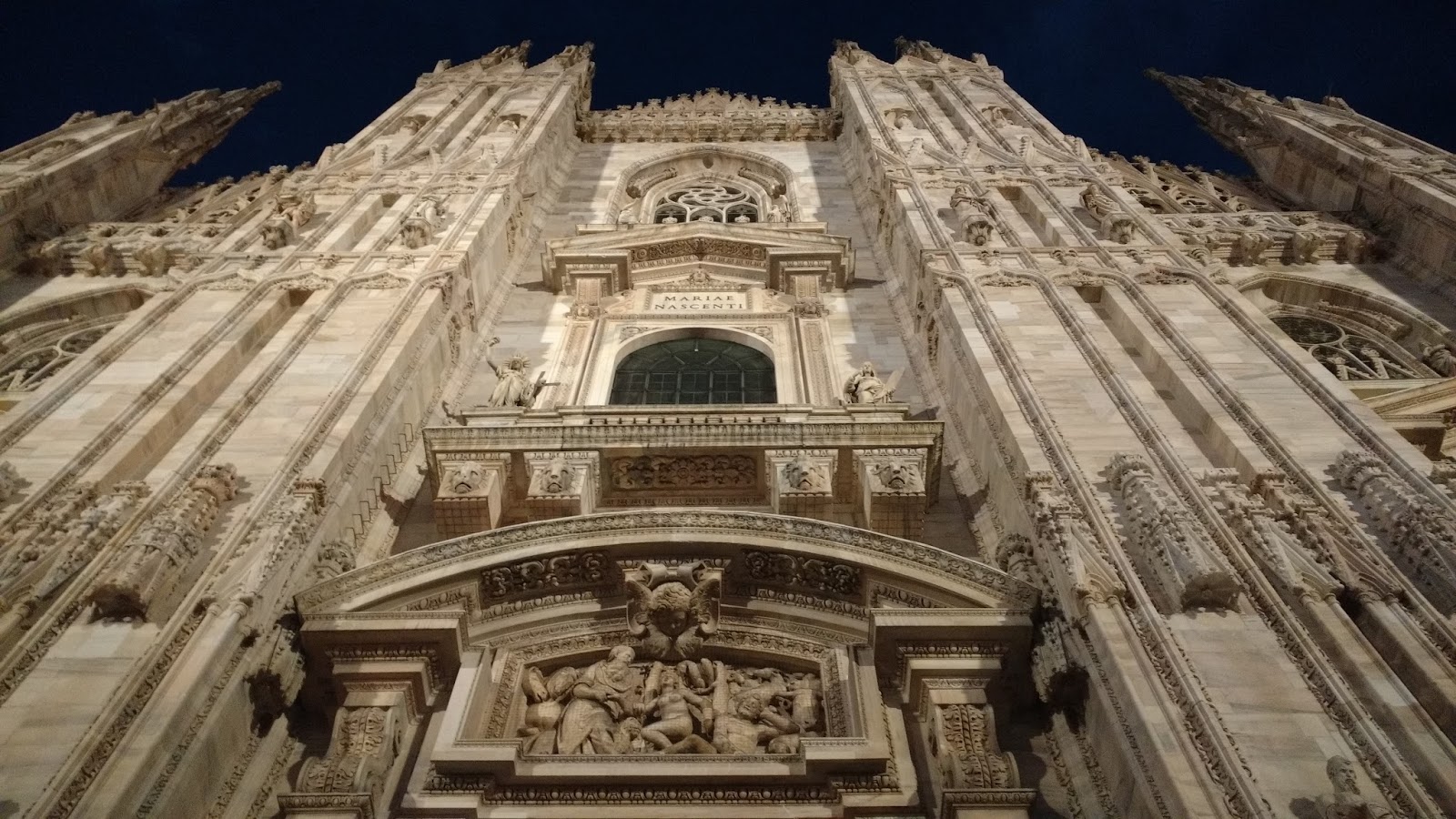
After a moment of respite we went to the market, where the main goal of our trip was, that is, belonging to the largest churches in the world, the Cathedral of the Birth of Saint.Maria in Milan.


We started the tour with the museum, where you could see fragments from the Cathedral and learn a bit about its history.


Then we went to the interior of the Cathedral, which was a real architectural phenomenon. Everything there was remarkably refined. Particularly noteworthy were the enormous, stunning stained glass windows.


The next point of the visit was the roof of the Cathedral. He did not give in to anything within her. There were many spectacular fialas, sculptures and all gargoyles.


Thanks to the perfect air transparency that day, we were lucky to see the Alps stretching over the horizon.

After visiting the cathedral, the final point of our trip was pizza, ordered in a great pizzeria Caffe 'Panzera, near the station.


The landscape began to slowly change from green, calm, valley to more harsh and rocky.


From time to time, the view of the majestic glacier and the Vincent's Pyramid towering above it pierced through the mist. This image on the one hand was delightful, but on the other hand, it aroused respect.


More or less halfway from Rifuggio Gabiet to Mantova, there is a chance to stay in one hostel, Orestes Hutte.

It looked very inviting from afar. An interesting fact is that it is a vegetarian-friendly place because it offers only vegetarian dishes.
In order to get to it, it was necessary to go a bit off the trail, so that after a dozen or so minutes to be at the shelter.


We, however, decided to go further, hoping that we will be at the beginning of Mantova before the rain or worse.
Unfortunately, the clouds had completely different plans and surprised us an hour before the shelter. Literally, in one moment a storm broke out, on one side it was terrifying, but on the other it was also amazing. Thanks to it, we literally felt the power of nature.


Fortunately, the convenient stone pit that served as a shelter helped to wait out the raging storm.

After less than 40 minutes of real, sky-high cinema, using the momentary weather window, we went up. The terrain turned into a rocky-snowy road.


The weather window did not last long, however, and before we looked again, we were in a storm cloud. The only thing that could be done in this situation was to drive towards the shelter as much as possible in the legs and lungs.
Time lengthened mercilessly, so that the last hour of the approach seemed to last for all eternity and the cloud-scattering contour of Rifugio Città di Mantova approached very slowly. The whole thing was complemented by fatigue that was noticeable.
It's hard to describe how big was our joy when we finally reached the last stone steps that ended on the terrace of the hostel.

Rifugio Città di Mantova turned out to be a very large and modern hostel, built on a rock, with a huge mountain dining room. In its offer has delicious food and accommodation. The only drawback was the lack of showers. Below is a link to the hostel's website:
http://www.rifugiomantova.it/

Day 3 (acclimatization). Rifugio Città di Mantova - Capanna Gnifetti
"To love the mountains, you do not have to see them, if you love a dearest being, you do not necessarily have to see or hear them talking to us - all you have to do is be present in the mountains - they exist and that's enough."
Colette Richard

The morning in the Mantova shelter began as it often happens in alpine shelters before sunrise. Most of the people staying at this altitude planned to go high in the mountains, usually to the shelter of Capanna Margherita, located at the top of Punta Gnifetti. It was connected with the passage through the glacier, which is definitely safer in the morning. In later hours, the sun significantly weakens snow bridges covering its crevices. The later you visit the glacier, the greater the risk of falling into the gap. That's why life in alpine, higher shelters usually starts around 4 am or even earlier and some alpinists make their first steps even by the light of the headlamps.
We did not have to hurry so much that day. We had one goal - acclimatization. Originally, we planned to reach the Gnifetti hut, which we chose as the main base, from where after lodging and leaving things we wanted to set off a little above the shelter, to the glacier, to get to know the terrain and get the organisms to the heights. Unfortunately, due to unfavorable weather, the whole plan could not be implemented.

Initially, starting the day with breakfast in Mantova, we collected the items and about 9 o'clock we set off up to Rifuggio Gnifetti.
The route from Rifuggio Mantova to Gnifetti is very simple. The hostels are very close to each other. They are separated by about 40 minutes mainly of the snowy passage being the remnant of the Garstelet glacier.
In addition, the second shelter is clearly visible from one.

Before we looked back, after defeating the snowy bend, we got to the short ferrata that led to the hostel terrace.

Rifugio Gnifetti looked amazing from the bottom up, but at the same time it filled with even greater admiration. We decided unanimously that it is the best shelter we have ever visited.


It was built on a rock at an altitude of 3647 m above sea level. It is unique due to the fact that it is a direct neighbor of the huge Lys glacier, as well as four-thousanders lying on it.


From the terraces and windows there is a marvelous view of the alpine peaks stretching all the way to the horizon, including the Gran Paradiso and Mont Blanc massifs, as well as the view of the downhill slope of the Lys glacier with its huge crevasses.
All this together impressed the eyes.


We were pleasantly surprised by the conditions that prevailed inside. Positive staff, who despite the "crowds" very well took over the situation, delicious food, which nobody expected at this altitude, a large selection of local beer, access to showers, bathroom with a view of the glacier, comfortable, 3-story beds, warm rooms .. you could exchange and exchange like that.


After settling in and repacking heavy backpacks, the weather effectively thwarted our plans for going somewhere higher, to the glacier area, for acclimatization purposes.Rifuggio Gnifetti suddenly became a place like a dream. We were literally in the cloud.Such a state, unfortunately, lasted for most of the day, alternating with snow, storm and temporary sunshine.


Nothing, however, lost because during waiting, to our surprise, we were lucky to meet two great Polish teams :)


Day 4. Ludwigshöhe, Balmenhorn
" Look deeply into nature, and then you will understand everything better."
Albert Einstein

Today we woke up a few minutes after 4 o'clock. Despite such an early season and the fact that even the sun still sleeps well, the whole hostel has been full of life.
But we were completely lifeless this morning ... Altitude sickness in a remarkable way let us know.
We did not expect it to be so badly the more so that the previous night we spent just 200 meters below without any symptoms.
It was hard for us to get out of bed, not to mention moving or eating anything.
She manifested herself mainly with headache, dementia and lack of appetite ... And you had to eat, after all the glacier waited.
...
In the end, we managed to collect somehow, prepare the equipment, tie the rope so that we were ready to wander.
After leaving the hostel fresh and cold air and great views definitely improved our condition.
The weather was fantastic and the transparency of the air was so amazing that we could easily see the Mont Blanc and Gran Paradiso massifs on the horizon.


On that day, we were planning to identify the situation on the glacier regarding the number of gaps and possible threats. We also wanted to see how the road to peaks really looks like, which we planned to get in Poland and which we knew only from maps, photos and guides.
To get even better acclimatization, we also planned to go to one of the four-thousanders closer to the hostel.


To get to the glacier, you had to leave the safe rock cape on which stood Rifugio Gnifetti and descend using a short ferrata located at the end of the stone path at the back of the hostel.
After getting to the area, the path clearly visible, trampled by the earlier teams determined the further part of our journey.


Taking the heights, we were heading up the glacier.
The initial sections of the road were quite crevice and demanding.


We were walking among the powerful peaks.


On the right, the Vincent Pyramid towered above us with its stunning rock wall, decorated at the foot of giant ice seraks.


As we moved up, on the left side two Lyskam tops showed up.
On the first of them, Lyskamm Orientale (Lyskamm East) ran an amazing snow, steep ridge.


After defeating the first elevation, we reached the plateau of the Lys glacier.


From this perspective, the Vincent's Pyramid no longer made the impression of such a difficult and inaccessible mountain. The path that led her ran calm, snowy turns.

The rocky peaks of Corno Nero (Schwarzhorn) 4 322 m above sea level and Balmenhorn 4167 m above sea level appeared in front of us with a huge statue of Christ (Cristo delle Vette) visible on its top and Bivacco Felice Giordano shelter.

As the height of the Corno Nero grew, it appeared to be an increasingly interesting mountain with a very steep slope separated by a fissure.


We wanted to go as far as possible and as far as possible to see the path leading to the peaks of Punta Gnifetti (Signalkuppe) and Punta Parrot (Parrotspitze), which we planned to get the next day.
For this purpose, a narrow snowy ridge of the Ludwigshöhe summit was the best, from which the next part of the glacier was well visible.

As we approached, the sun rose higher and higher, pleasantly elevating the temperature of the surroundings, and strong gusts of wind soaked up the clouds of snow, creating spectacular performances.


The Ludwigshöhe summit, 4341 m above sea level, actually turned out to be very narrow.


When we passed it, the wind effectively took care that we would not be bored. A fairly strong breeze meant that the passage was exciting and the view of the other side of the glacier intensified these emotions :)

After descending from Ludwigshöhe, due to the early hour, we decided to enter the Balmenhorn. The road did not cause any difficulties. At the rock itself there was a short ferrata that led to the top.

On it stood a huge figure Cristo delle Vette with a height of 3.6 m and a weight of 980 kg.It was built in honor of the memory of the fallen of all wars.


We were very surprised by the conditions that prevailed in the local shelter. It was equipped with solar screens which ensured access to electricity.
In the middle there was a place to prepare a meal, a gas stove, a wooden table and benches, and a place to sleep. The surprise was also the fact that the range contained mattresses and blankets.

From the balcony there was a view of the steep, rocky slope of Corno Nero and the road leading to the top of the Vincent's Pyramid.


After leaving Balmenhorn we headed back towards Rifugio Gnifetti. The road took us about an hour and was filled with beautiful views.


The day ended with a beautiful sunset that we could see from the Gnigfetti hostel :)


Day 5. Punta Gnifetti (Signalkuppe) and Punta Parrot (Parrotspitze)
"Mountains are a great area for acquiring this power, which is captured in the mountains and then yields in the valleys. Only in the life of the valleys is the value of the mountains fulfilled and their impact on humans is proven."
Fr.. Roman E. Rogowski

Martyna Wojciechowska
It was still dark outside ... and although it was not easy, we woke up at the alarm clock at 4:30.
As every day, the hostel was vibrant with life at this time.

That morning the morning looked completely different. Fortunately, altitude sickness has gone forever. There was no headache, no dementia, no lack of appetite. We felt great, motivated and ready to act.
A new unexplored part of the glacier and above all two amazing peaks awaited us:
- Punta Gnifetti, from the German Signalkuppe, at its peak, at 4554 m above sea level, stands the highest located tourist hostel in Europe.
- Punta Parrot or Parrotspitze 4432m above sea level, a great, long snow ridge high in the clouds.
Even breakfast this time tasted exceptionally good. The charms surrounding the mountains emerging from the darkness added to his charm.

This time, we did not have to prepare too long to leave.
We packed our backpacks and equipment the day before, so that they waited in readiness.
All you had to do was dress up the crampons, tie up the rope and check the belaying.


The weather of that day seemed to be even better than yesterday, and the air was so clear that we could admire the amazing beauty and power of the mountains to the horizon.

We defeated the first fragments of the glacier in the light of the rising sun.
Just like yesterday on the right we passed the Vincent's Pyramid, on the left an amazing Lyskamm ridge, and finally after reaching the first elevation we reached the Glacier Plateau.


This time we left Balmenhorn, Corno Nero and Ludwigshöhe behind us and after crossing the Lys Pass, we reached the Grenz Glacier.


What we saw after exceeding a slight surpass exceeded our wildest expectations.


Three huge peaks appeared to our eyes, from the left: Dufourspitze, Zumsteinspitze and Punta Gnifetti.


To the east stretched a vast panorama, against which the characteristic Matterhorn peak was clearly visible.


Continuing our journey along the eastern slope of the Parrotspitze after about 30 minutes we found ourselves in a place where the road went steeper and led to the Gnifetti mountain pass (Colle Gnifetti) separating the peaks of Punta Gnifetti and Zumsteinspitze.


The entrance to the pass was relatively easy. It did not cause any orientation problems, especially since everyone moved the same, well visible, well-trodden path. Rather, it was associated with a painstaking journey along a strongly sloping snowy slope. The only drawback was the altitude, which most gave itself to know on the steep sections of the road and enforced the slower pace of the march.


Only the last but the most difficult 102m approach was left from the pass.
Time was very long and our goal was not approaching at all.
Finally, after defeating a long hump, we were able to enjoy the summit! :)


In the mountains you can see many beautiful landscapes, but the view from Punta Gnifetti was something special. We were literally above the clouds.


Looking in the direction from which we came, you could admire the amazing panorama of most of the peaks of the Monte Rosa massif.
In the immediate surroundings from the left you could see: Parrotspitze, Roccia della Scoperta and Lyskamm, while on the right - Zumsteinspitze and partially covered by the highest peak of the Dufourspitze massif.
In the background there was a characteristic Matterhorn in the vicinity of other towering mountains, among others Dent Blanche and Weisshorn.

Looking the other way, we were enchanted by the sight of an amazing, several hundred meter chasm, below which the peaks of the lower mountains and the beautiful green valleys of Alta Valsesia and Alta Val Strona crossed the sea of clouds.


For over 100 years at the top of Punta Gnifetti stands a very modern hostel / observatory.It is worth emphasizing that it is the highest located tourist hostel in Europe.
He mainly conducts high-altitude scientific research and improves rescue operations.


It also has sleeping places (for 70 people), bathrooms, a bar and electricity.
While there, we had the opportunity to drink a delicious coffee by the window with a view of the Dufourspitze.


After an hour's break and recharging, we went on a further journey. Our next goal was to get the Parrotspitze summit and the passage of its incredible snow peak.
To do this, we had to go back exactly on our tracks: first to the Colle Gnifetti pass separating Punta Gnifetti from the nearest neighbor, Zumsteinspitze and then to the Seserjoch pass visible below, which separated the peaks of Punta Gnifetti and Parrotspitze.


The Seserjoch Pass is located at an altitude of 4296 m above sea level, so we were losing altitude by over 250m. The long snowfall that we have recently covered in the previous direction has passed very quickly.
After about 40 minutes after leaving the Punta Gnifetti summit, we started approaching the Parrotspitze.


The weather began to deteriorate significantly, the wind was getting stronger and the visibility weakened.
Being on the pass, we had a lot of doubts whether we should go on.
Now we do not regret this decision.


A few minutes after leaving the pass we entered the peak of the Parrotspitze.
A chasm covered by the clouds below fell to the west and a steep snowy eastern slope was separated by a narrow path leading once along the sharp edge of the ridge, and at other times in its immediate vicinity.


The Parrotspitze ridge is a great place to feel the real power of nature and to realize the majesty of the mountains.


After spending about 30 minutes high in the clouds, the road began to descend and point us back towards the glacier. The descent from the summit ended with a short rock climb in an easy terrain (you should still be vigilant there).

After descending from the rocks, we headed for the Vincent's Pyramid and returned to the well-known way to the shelter.

During the descent from one side we were accompanied by a feeling of great happiness due to a very successful mountain adventure, on the other hand, however, slowly came to us the thought that the Alpine journey is coming to an end.

Day 6. Capanna Gnifetti - Alagna
" The exit is easy.
The return requires (...) an effort of will,
because it is much more difficult. "
Terry Pratchett
The day started for us later than usual. Completely ignoring the morning hustle and bustle, we slept through sleep deprivation and gained strength for the return journey.
That day, we were no longer aiming to gain great peaks, we just wanted to go down to the Alpine village of Alagna at the foot of the Monte Rosa massif.


The mountains said goodbye to us with the beautiful sunny weather that accompanied us until the evening.
We did not rush, we started to descend only around 10 o'clock.


The first point, which we had to look at was located near the hostel Mantova.
A few days earlier, in order to get rid of the excessive weight, we left a tent there.
The road to Mantova did not cause us any difficulties. The lower located hostel is clearly visible from the terrace of Capanna Gnifetti.
To get there, we had to go down a well-insured ferrata and then go through a long snowbank through the small Garstelet glacier.


An additional charm of our way of descent was added by the fact that we planned the return with a completely different route than at the entrance.


At the station of the queue we met a very nice surprise. A herd of tiny Alpine ibex grazed near the building, which was not disturbed by the presence of people.


The further course of the road turned out to be very uncertain.
At this point it was necessary to head east (to the left) to the visible, now closed station of the cable car on Punta Indren.
The road led through a rocky terrain alternately intertwined with large snow patches.


Then the road led towards Stolenberg, which is just in front of us - another surprise of the day.


The trail led a beautiful and delicately displayed road traverse the slope of the mountain rising up and approaching its peak but eventually not reaching it. We then made one attempt to get the mountain "on our own," however, the falling of small stones effectively changed our decision.


Being on the other side of Stolenberg, we found ourselves on the pass Passo dei Salati, where there was another, modern station of the ski lift. Below it, there was a hostel building.


Going further, with the loss of altitude, our goal began to show up and the end point of the trip - the town of Alagna Valsesia. We went there, however, much longer than one would expect. Along the way, we passed the last station of the roller coaster leading to Alagny-Pinnalungne.


From the station, the trail ran along a wide and winding road. After about two hours of walking (around 5 pm), we finally got to the desired Alagny.


We were really hungry and tired. Our priority has been to find the BEST pizzeria in the town. Unfortunately, all the residents we asked pointed to the closed pizzeria Dir und Don located in the central square
Piazza Regina Margherita. It was to be opened only at 19.00.


The long waiting time forced us to search again. In this way we came across a seemingly even better place - the Caffè delle Guide, where the cuisine served local delicacies and, above all, the coveted Italian pizza and excellent local beer.


After a great dinner, it's time to find accommodation.
It turned out that less than a kilometer from the center of the town is a great campsite - Campeggio Alagna.
After leaving the restaurant, it was enough to turn right at the church and the main street - Via dei Walser, running through the whole village, keep going straight to the roundabout.
At the roundabout, turn right to stand in front of the campsite gate.
The camping turned out to be a place at a really very high level.
At the gate there was a restaurant serving guests meals, where you could also buy items needed for survival at the campsite.
The camping was also equipped with very neat and modern bathrooms.

Restaurant Dir und Don turned out to be a very atmospheric place, and the people asked before were right ... Pizza was outstanding!

Day 7.8. Vercelli-Alagna-Milan-Cracov
"The world is a book and those who do not travel read only one page."
Saint Augustine
" Travel and dreams have been the biggest benefactors in my life"
Nikos Kazantzakis; writer, philosopher
Day 7
That day, he did not wake us up as we expected, but the alarm clock above our heads, supplying high-mountain shelters with necessary goods.
There were a few moments to leave, so we could go through the charming town of Alagna once again. Thanks to this, we found a delicious, natural ice cream from alpine cream.
Around midday, we expected a bus that would take us to Vercelli, from where it was easy to get to Milan.
The road from Alagny to Vercelli was beautiful. It lasted about 2 hours and led through charming, smaller towns and picturesque mountain areas.

Vercelli itself turned out to be a neat, historic city with numerous historic buildings and a nice market square.


In an amazing way, both outside and in the middle, presented in 1224, the Basilica of Saint Andrew.


We spent a few hours visiting Vercelli. We only had to get to Milan.
The train journey did not last long, because about an hour. Cities are 90 km apart.

This time, Milan greeted us at his mighty main station. Like in every other big city there was a huge chaos. It was completely opposite to Alagny and Vercelli, abounding in order, peace and order. Everyone was in a hurry. And as it turned out, time was also ruthless for us, because the coach, which we could return to Poland, was only 2 hours. After a short reflection, we decided that it was not enough and that we would stay one more day longer. It would be a great loss to be in one of the most famous European cities and not even to feel its charm.
We started the sightseeing tour from an evening walk in the old town. A huge market, in the center of which one of the largest and most beautiful cathedrals in the world was erected, in its splendor seemed almost unreal.

Thanks to the fact that we decided to stay, we could spend the next day to get to know Milan.
Day 8
We started the day with a great breakfast in a unique place which was the Pave restaurant. It is worth mentioning that the Italian coffee marochino, which Milan is famous for, served with the addition of cocoa is very recommendable.

Then we went to the Giardini Pubblici Indro Montanellin park, named after the journalist Indro Montanelli. We were very positively surprised by the climate that prevailed here. It was an ideal solution for people who want to take a break from the hustle and bustle of the city as well as their dog friends. The area of the park was covered by the dog zone, which means that they could run slowly there. However, we were most surprised by the turtles that inhabited the lake located in the central part of the park.


After a moment of respite we went to the market, where the main goal of our trip was, that is, belonging to the largest churches in the world, the Cathedral of the Birth of Saint.Maria in Milan.


We started the tour with the museum, where you could see fragments from the Cathedral and learn a bit about its history.


Then we went to the interior of the Cathedral, which was a real architectural phenomenon. Everything there was remarkably refined. Particularly noteworthy were the enormous, stunning stained glass windows.


The next point of the visit was the roof of the Cathedral. He did not give in to anything within her. There were many spectacular fialas, sculptures and all gargoyles.


Thanks to the perfect air transparency that day, we were lucky to see the Alps stretching over the horizon.

After visiting the cathedral, the final point of our trip was pizza, ordered in a great pizzeria Caffe 'Panzera, near the station.
